District 1

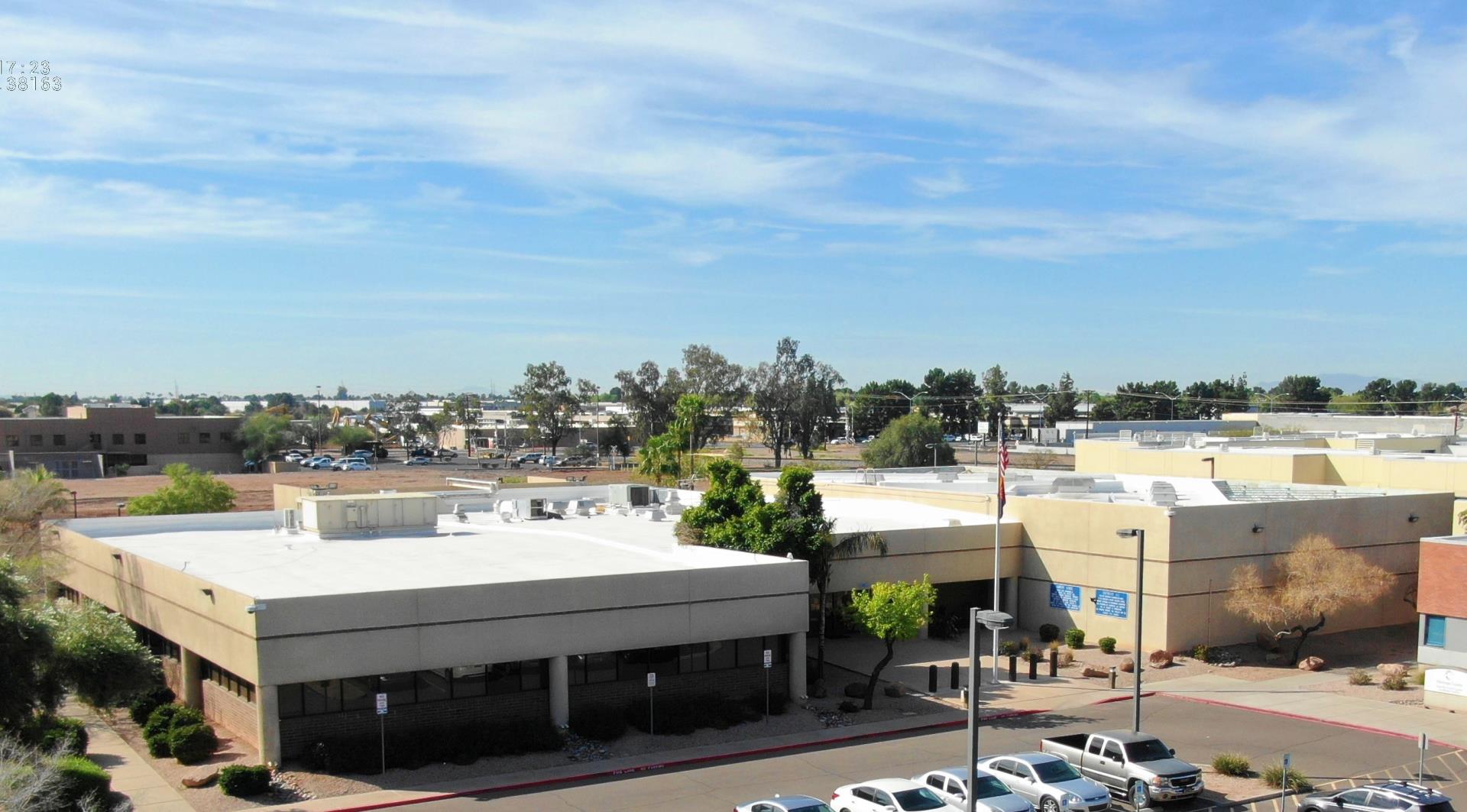
1840 S. Lewis St.
Mesa, AZ 85210
Location: (Map it)
Phone: 602.876.1853

District Boundaries:
North: Indian School Road
South: Hunt Hwy (County Line)
East: Meridian Dr. (County Line)
West: 16th St

Communities inside District 1 where MCSO is primary or backup law enforcement agency:
  • Apache Junction
  • Chandler
  • Gilbert
  • Guadalupe
  • Mesa
  • Tempe
  • South Scottsdale
  • Sun Lakes
  • Queen Creek
Staff:
Captain: Dave Letourneau
Lts: 3
Sgts: 8 Patrol Sergeants, 2 Detective Sergeants
Deputies: 49
Detectives: 8
Number of Admin Staff: 2

Unique Features:
  • most populous of all districts served by the Sheriff’s Office as well as the most ethnically diverse district.

District 2

920 E. Van Buren Street.
Avondale, AZ 85323
Location: (Map it)
Phone: 602.876.1865

District Boundaries:
The boundaries of District 2 are approximations.
North: Northern Avenue Alignment
South: Pima County/Pinal County line
East: Central Avenue
West: Yuma County / La Paz County Line

Communities inside District 2 where MCSO is primary or backup law enforcement agency:
  • Southwestern areas of Phoenix metropolitan area (Laveen)
  • Litchfield Park
  • Gila Bend
  • Tonopah
  • Mobile
  • Arlington
  • Wintersburg
  • Rainbow Valley
  • Buckeye Valley
  • Harquahala Valley
  • Parts of Goodyear, Avondale, Glendale, and Buckeye.
  • Unincorporated Maricopa County land.
Staff:
Captain: Shawn Braaten
Lts: 3
Sgts: 12
Deputies: 49
Detectives: 8
Number of Admin Staff: 2

Unique Features:
  • Encompassed within District 2 is Luke Air Force Base, Palo Verde Nuclear Generating Station, Phoenix International Raceway, the University of Phoenix Stadium (home of the NFL’s Arizona Cardinals), and a large portion of the Barry M. Goldwater Gunnery Range.
  • Also inside District II are several Maricopa County Jail facilities including 4th Avenue, Lower Buckeye, Durango, Towers, as well as, the Sheriff’s Office Training Facility, Institutional Services and the Property and Evidence facility.
  • The Arizona Department of Correction’s Lewis Prison complex is located in Buckeye, and Perryville Prison Complex located in Goodyear.
  • We have enforcement responsibilities in several locations in downtown Phoenix including response to the Superior Courts and Sheriff’s Headquarters building and Chase Field (home to the MLB’s Arizona Diamondbacks).
  • We have multiple county recreational parks located in the patrol district to include White Tanks Regional Park, Estrella Park, and Buckeye Hills.

District 3

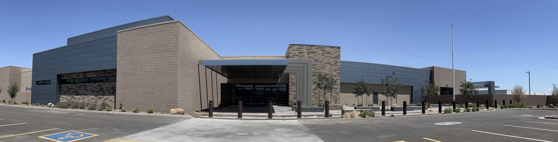
13063 W. Bell Road,
Surprise, AZ 85374
Location: (Map it)
Phone: 602.876.1602

District Boundaries:
North: Yavapai County line
South: Northern Avenue
East: I-17
West: La Paz County line

Communities inside District 3 where MCSO is primary or backup law enforcement agency:
  • Sun City and Sun City West
  • The Town of Youngtown (contract municipality)
  • Wittman
  • Waddell
  • Circle City
  • Morristown
  • Whispering Ranch
  • Aguila
  • Gladden
  • Unincorporated areas surrounding Glendale, Peoria, Phoenix, Surprise, El Mirage, and Wickenburg
  • White Tanks Park
  • Vulture Mountains Recreation area
Staff:
Captain: Frank McWilliams
Lts: 3
Sgts: 14
Deputies: 60
Number of Admin Staff: 2

Unique Features:
  • District 3 ranks as the second largest district area covering 1600 square miles, with the most calls for calls for service.
  • The area is a mix of rural farms to densely urbanized communities which include two very large senior retirement communities, Sun City and Sun City West, with a total combined population of over 60,000 residents.
  • Additionally, a large population of seasonal workers come to the town of Aguila for six months in each calendar year. Deputies from District 3 work closely with this population to build strong, positive relationships with them through school activities, food drives, sporting competitions and a Christmas toy drive.

District 4

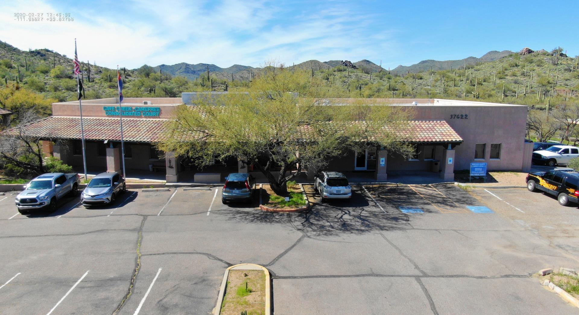
37622 N. Cave Creek Rd.
Cave Creek, AZ 85331
Location: (Map it)
Phone: 602.876.1742

District Boundaries:
The boundaries of District 4 are not symmetrical, so the following are approximations. North: Yavapai County line
South: Indian School Rd
East: 136 St
West: I-17

Communities inside District IV where MCSO is primary or backup law enforcement agency:
  • Northern areas of Phoenix and Scottsdale
  • Parts of Peoria
  • Unincorporated Maricopa and Yavapai County land
Staff:
Captain: Dan Whelan
Lts: 3
Sgts: 10
Deputies: 26
Detectives: 5
Number of Admin Staff: 2

Unique Features:
  • Anthem is quite often the busiest patrol beat in Maricopa County
  • This district also services two contract Cities/Towns – Carefree and Cave Creek.
  • District 4 deputies also provide services for Clearwater Hills located in Paradise Valley

District 6

20727 E. Civic Parkway,
Queen Creek, AZ 85142
Directions: Between South Ellsworth Loop and South Ellsworth Road on East Civic Parkway
Location: (Map it)
Phone: 602.876.5055

District Boundaries:
North: Germann Road
South: Hunt Highway
East: Meridian Road
West: Power Road

Staff:
Captain: Greg Lugo
Lts: 1
Sgts: 8
Deputies: 28
Special Services Deputies: 3
School Resource Deputies: 2
Detectives: 3
Number of Admin Staff: 3

Unique Features:
  • The Town of Queen Creek and District 6 lay in the far southeast corner of Maricopa County with part of the corporate town limits falling into Pinal County.
  • Queen Creek is a contract city with the Maricopa County Sheriff’s Office for its law enforcement services. The town incorporated in 1989 to help preserve the rural atmosphere threatened by the rapid growth of the east valley. Most of the residential lots in Queen Creek are zoned one acre or larger, making it very attractive to those who prefer life with a country flavor.
  • Sheriff’s Office personnel in District 6, along with our Queen Creek Town partnership, focus on the principles of Community Policing, Intelligence Led Policing and Directed Patrol Management to deliver an excellent police product to all residents and visitors of the Town.

District 7

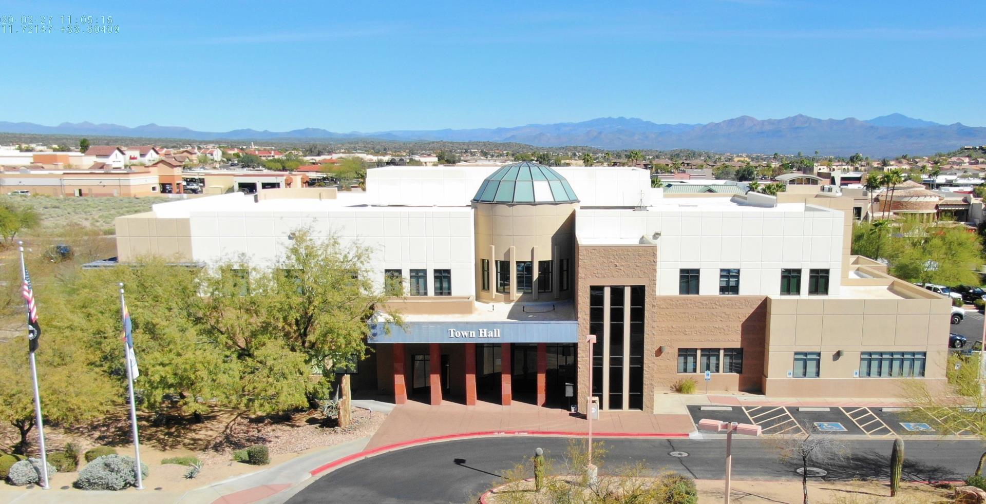
16705 E. Avenue of the Fountains
Fountain Hills, AZ 85268
602.876.1869
Location: (Map it)
Phone: 602-876-1869;
480-837-2047;

District Boundaries:
(approximations)
North: Carefree Highway
South: Axis Dr.
East: State Route 87
West: Flying Butte

Communities inside District 7 where MCSO is primary or backup law enforcement agency:
  • Unincorporated areas north and east of Fountain Hills
  • Assistance provided to Fort McDowell Police, Scottsdale Police and Department of Public Safety.
Staff:
Captain: Larry Kratzer
Lts: 1
Sgts: 8
Deputies: 20
Detectives: 3
Number of Admin Staff: 1

Unique Features:
  • District 7 enjoys a contractual agreement with the Town of Fountain Hills to provide law enforcement services.
  • The district is also responsible for law enforcement services to the unincorporated areas of Scottsdale, Rio Verde, Tonto Verde, Trilogy at Verde River and Goldfield Ranch.

Lake Patrol

7307 N. Bush Hwy.
Mesa, AZ 85215
Phone: 602.876.1636

District Boundaries:
North: Yavapai County line
South: Carefree Highway on west side and Brown Road on east side
East: Gila County line
West: Castle Hot Springs Road

Communities inside the Lake District where MCSO is primary or backup law enforcement agency:
  • Tonto National Forest
  • Mesa
  • Cave Creek and part of the Tonto Basin
  • Town of Sunflower
  • Lake Pleasant and Usery Mountain Regional Parks
  • Maricopa Flood Control District
Staff:
Captain: Fred Aldorasi
Lts: 3
Sgts: 12
Deputies: 34
Detectives: 3
Number of Admin Staff: 2
Other: One (1) Horse Groom, Three (3) K-9 deputies with two (2) tracking K-9's and one (1) dual-purpose K-9.

Unique Features:
  • Lake Patrol covers all of the wilderness area and waterways of the Tonto National Forest within Maricopa County as well as Lake Pleasant and Usery Mountain Regional Park.
  • Lake Patrol is also responsible for Search and Rescue Missions, Dive Recovery, Mounted Patrol, Concentrated Traffic Enforcement, Flood Control District Enforcement, The Sheriff’s Medic Program, Mobile Field Force, and initial response to any emergencies involving the Palo Verde Nuclear Generating Station. Deputies patrol by traditional methods and with the use of off-highway vehicles, watercraft, and horses.